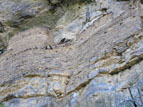
The condition of most ruins in Arizona is directly proportional to the difficulty of access. Devil's Chasm ruin is in spectacular condition, which tells you something about the hike. Though the trail is less than two miles one-way, it climbs almost two thousand feet in elevation and passes through some of the most challenging terrain in Arizona.
The hike starts out easily enough. From Cherry Creek Road a well-used trail follows the left side of the creek up into Devil's Chasm, heading southwest. After a quarter of a mile or so the creek forks, with the trail following the left branch. Soon the walls of the canyon begin to close in, and hiking becomes more difficult. If you are carrying a GPS or cell phone, don't expect it to work here. About three quarters of a mile into the hike the path is blocked by a sheer, twenty-foot waterfall (photo 13). The only way around is to scale the canyon wall on the right side, squeezing under a ten-foot boulder that forms a sort of tunnel leading to the top. Sometimes people leave ropes here that you can use to pull yourself over the hard spots, but don't count on it. Experienced climbers won't have a problem, but if anyone in your group has difficulty with heights, you should bring your own rope.
Two hundred yards past the first obstacle you will encounter a second waterfall (photo 14). In the dry season it may be easy to scale, but water makes it far too slippery. There is a way around to the right, but anyone with a height problem will not be a happy camper at this point.
Above the second waterfall, the trail disappears altogether. The best advice I can give is to stay high on the left side of the creek as long as you can, and then drop back into the creek bottom. You won't be able to see the ruin from the creek due to the steep canyon walls. Look for a house-sized boulder wedged against the right side of the creek bottom. If you walk above the boulder you'll find that the trail reappears, leaving the creek and climbing diagonally up the right side of the canyon.
The hiking here is miserable. The ground consists of loose talus and fine dirt that rises in dusty clouds, covering your skin and clothes and clogging your lungs. The trail is so steep and the ground so loose that climbers have to spread out to avoid being hit by debris dislodged by the person ahead. But then you top out on a ridge--and there it is!
The ruin blends so well into the cliff face that you may not see it at first. Access is from the left side, and the only way to reach the ledge on the right is to pass through the interior of the ruin. The doors are very small. If you have a daypack, leave it outside. But bring your camera--you'll definitely want it.


